Prescribed burns could affect hunters, hikers this fall
Published 9:00 am Friday, September 15, 2023
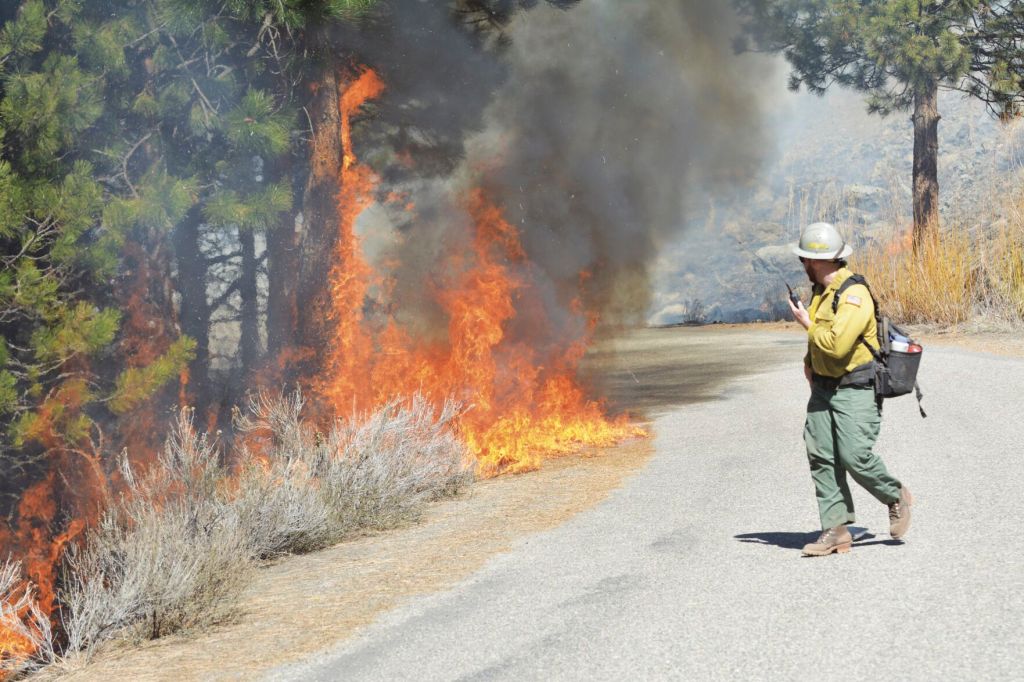
- Nick Schramm, of the La Grande Hot Shots firefighting crew, keeps an eye on a prescribed fire burning near Phillips Reservoir in April 2021.
LA GRANDE — Prescribed burning on the Wallowa-Whitman National Forest this fall could result in temporary road and trail closures during the most popular hunting seasons, forest officials announced this week.
Any closures likely would last for two to five days, officials said.
Whether or not the Wallowa-Whitman lights prescribed fires depends largely on weather. Conditions have to meet certain standards — basically, neither too dry nor too wet — before officials approve burning plans.
Other factors, including wind speed and direction, temperature and humidity, also influence the decision of whether or not to ignite a prescribed fire.
“With the recent storm systems that moved through late August, higher humidity, and lower temperatures across the forest, many areas are conducive to successful prescribed fire implementation in the near term,” according to a press release from the Wallowa-Whitman.
In many years the forest burns more acres during the spring than during the fall, but this year cold, damp weather persisted so long that very little prescribed burning happened.
Officials use fire to achieve multiple goals, including reducing the amount of fuel on the ground and thus curbing the risk of a large, fast-moving wildfire during the summer.
Prescribed fires can also spur the growth of native vegetations, including grasses and shrubs that are food sources for wildlife.
Fall burning is more likely to affect hunters and other recreationists, since the more popular hunting seasons happen during the fall. The rifle deer season starts Oct. 7, with major elk seasons in November.
“The Forest Service recognizes that hunting season coincides with prescribed burning season and can impact hunters, but controlled burns are necessary to reintroduce fire to the landscape and encourage healthy vegetation that will ultimately improve landscape residency and forage for big game,” according to the press release. “Hunters are asked not to camp or recreate in burned-out areas. Trees may be unstable and fall or drop large branches. This danger is heightened with high winds. Rocks and other debris can also be unstable and roll downhill or fall out from under a hiker’s boot or the weight of an ATV. The ground itself may be unstable due to burned roots and a lack of ground vegetation.”
To access the online map showing proposed prescribed fire areas, go to bmidc.org/rx_fire.shtml. Then click on “Blue Mountain Interactive Prescribed Fire Projects Map.”


