Spot fire breaks out near Imnaha Grange
Published 11:00 am Sunday, September 11, 2022
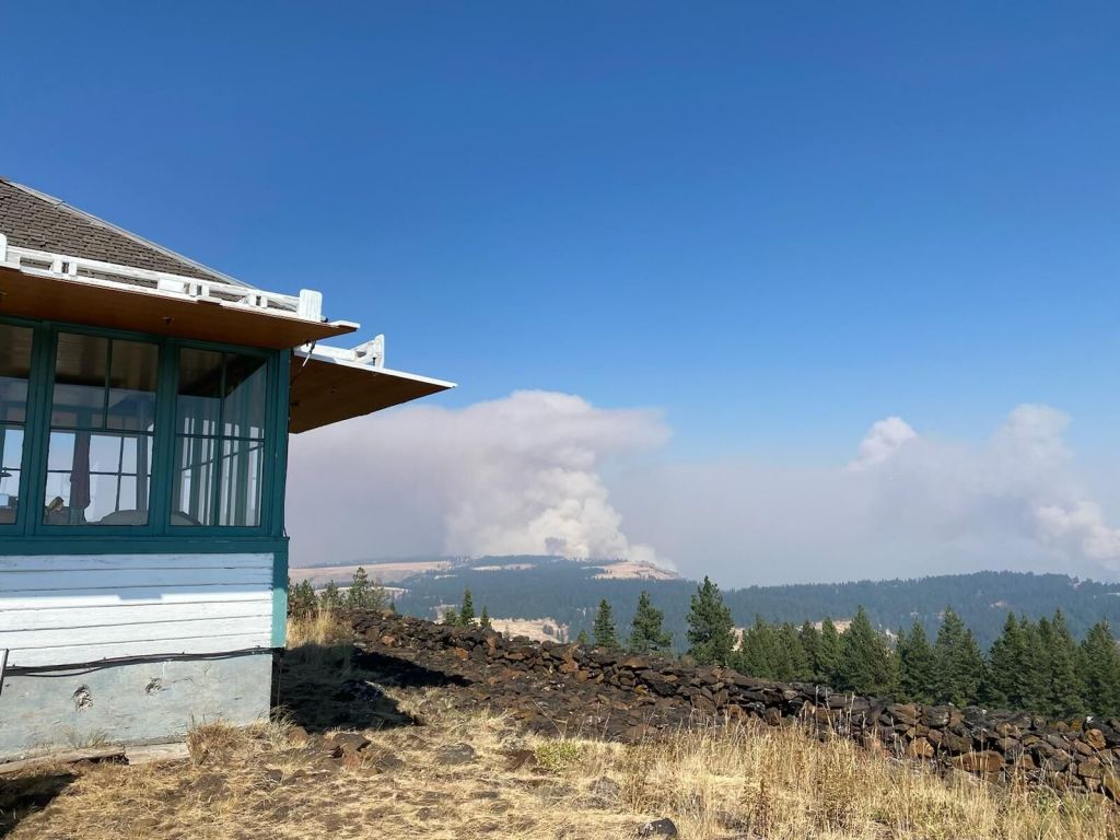
- Smoke can be seen from Harl Butte rising from the Double Creek Fire on Saturday, Sept. 10, 2022.
ENTERPRISE — The Double Creek Fire spotted across the Imnaha River on Saturday, Sept. 10, near Imnaha Grange, according to the Sept. 11 report.
Trending
The spot fire near Imnaha Grange is approximately 500 acres. Six additional large air tankers were called in to join suppression efforts aided by the support of Blue Mountain Interagency Dispatch Center, La Grande. The air tankers worked with resources from the Double Creek Fire, Nebo Fire, Oregon State Fire Marshal, local resources and tactical firefighting aircraft air attack on the spot fire. Crews from Double Creek and Nebo fires remained on the spot fire into the morning of Sept. 11, continuing suppression efforts.
The Double Creek Fire has now burned 152,301 acres and is 15% contained. There are 773 personnel assigned to the fire.
The River Group on the eastern side of the fire, along the Snake River, made good progress on structure protection along the fire side of the river and are near completion of those efforts. In the north, crews continue working on the east-west containment line and are exploring opportunities to further strengthen control features, according to the report.
Trending
Eagle Cap Wilderness Fires
Progress was made on the Nebo Fire Sept. 10 and existing fire lines were secured.
There was some fire activity on the north of the fire along Wing Ridge, but it does not threaten any values at this time. Most of the resources on Nebo Fire responded to the spot fire on Double Creek, helping provide critical assistance with heavy equipment and were able to push the spot fire away from nearby structures. Crew remains assigned to the Nebo Fire to reinforce and monitor the line as needed.
The Nebo Fire, which is burning 21 miles southeast of Enterprise near Mount Nebo, has burned 12,182 acres and is zero percent contained. There are 126 personnel assigned to the fire.
Fire activity was moderate on the Sturgill Fire Sept. 10 with minimal growth.
A rappel crew was inserted into the Bear Creek Guard Station to complete structure protection. Firefighters and heavy equipment in the Lostine corridor will continue work a shaded fuel break northwest of the fire.
The Sturgill Fire has burned 19,487 acres and is zero percent contained, according to the Sept. 11 update. There are 77 personnel assigned to fight the fire, which is burning 15 miles southwest of Enterprise.
Evacuations
A Level 3 (leave now) is in effect for Fence Creek north to Dug Bar and Freezeout south to the 39 Road. A Level 2 (get set to leave) is in effect for lands west of Imnaha River to Bear Gulch Road, south of Highway 350 to intersection of power lines and Harl Butte Road; Upper and Lower Imnaha Road from Fence Creek to Freezeout; and for Lostine River Road from Fir Road south to Two Pan, including all campgrounds and trailheads. A Level 1 (be ready to leave) is in effect for lands west of Bear Gulch Road, south of Highway 350 to power lines and Harl Butte Road and for Lostine River Road from Highway 82 to Fir Road.
Road closures
Several roads around Wallowa County remain closed.
Lostine River Road from Moffitt’s south is closed. Highway 350 (Little Sheep Creek Highway) at mile marker 6.5 is closed due to the following closures — Lower Imnaha Road and Dug Bar Road are closed, Upper Imnaha Road is closed, Hat Point Road is closed, and FS 39 Road is closed from Target Springs Junction to Ollokot Campground, including the Canal Road (3920) and Lick Creek Road (3925).
Smoky conditions
The Oregon Department of Environmental Quality has issued an Air Quality Advisory that is in effect until 2 p.m. Monday, Sept. 12, for Deschutes, Umatilla, Union and Wallowa counties. A smoke outlook for Northeast Oregon is available from the wildland fire air quality response program. Additional information can be found at PurpleAir website.
Marketplace


-
eEdition

-

-
